Hiking in Antiparos: Trails, Views, & Tips
In this post, you can discover five fantastic hiking trails to explore the inland and the coastline of Antiparos Island on foot and, if you want, they can also include a swimming stop!
This post has affiliate links. If you make a purchase, I might make a small commission at no extra cost to you.
Antiparos, though modest in size, features some hiking trails that are perfect to see the wonderful landscapes of the island, either following a coastal paths or an inland route.
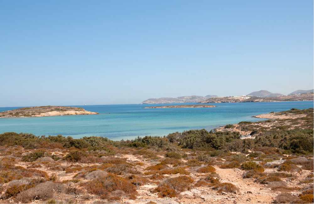
The Antiparos routes network feature some great walks through the island that come with lonely Cycladic churches and windmills, tiny whitewashed settlements, sea views, and green hills. Let’s see four popular hiking routes in Antiparos.
Five Fantastic Hiking Routes in Antiparos
Oliaros Trail
- About 5 kilometers
- Elevation 38 meters (124 feet)
- Low difficulty
- Loop
Considered the main hiking trail in Antiparos, this route is perfect to get a general insight to the island. This is a circular trail that takes about 1.5 to 2 hours to complete and is not particularly hard, making it suitable for everyboday, including kids.
By taking this route in the main town, you will pass its central paved road to reache Sifneikos and then head north to Agriokastro Cape, you will then head east to pass thourgh an ancient cedar wood and discover the coastal dunes.
North Coast Hike
- About 5 kilometers (there’s a longer 9-km version)
- Elevation gain about 30 meters (98 feet)
- Low to moderate difficulty
- Loop
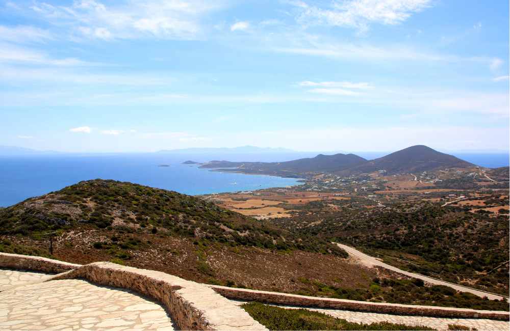
This is a longer trail that takes you to the north of the islands to explore the coastline and some fantastic secluded beaches.
The trail can be from 5 to 9 km (it offers two options). This is a loop hike of moderate difficulty which can be spectacular during sunset or, if done earlier in the day, it can allow for a swim in the shallow beach of Antiparos camping. After that, the coast gets more rugged, featuring rocky shores and the trail narrower.
The 5-kilometer trail is the easiest version, it can take a bit more than an hours, and it ends at Sifneiko from where you walk back to the center of the village.
Antiparos to Cave Loop
- About 12 kilometers
- Elevation gain about 180 meters (600 feet)
- Moderate difficulty
- Loop
This trail starts in Antiparos Town, heads inland to the Cave of Antiparos, then descends to the coast before looping back. As with most trails on the island, you are never to far from the coast, which is a pleasant addition if you enjoy taking a swimming break provided you don’t mind getting a away from the main trail.
This particular road features a mix of road and trail and it has a moderate difficulty with a moderate terrain gain and dantastic sea views.

Faneromeni Volcanic Formations
- About 8 kilometers
- Elevation gain about 88 meters (288 feet)
- Moderate difficulty
- Out and back
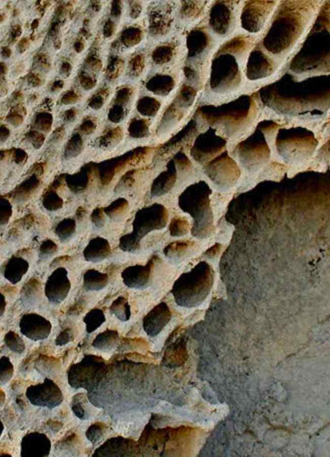
If dramatic landscapes fascinate you, then a hike to Faneromeni Bay on the southern tip of Antiparos is what you’ll enjoy the most. This area is known for its volcanic rock formations and striking geological features. One of the most fascinating sights here is a type of rock weathering known as tafoni — honeycomb-like cavities carved into the volcanic stone over thousands of years.
These formations are created through a natural process by which saltwater seeps into small cracks in the rock, and as the water evaporates, salt crystals exert pressure from the inside. Over time, pieces of the rock break off, slowly creating larger and larger hollowed patterns. The route takes about 2 hours.
The Faneromeni area is also part of the Natura 2000 network and shelters rare plant and bird species and is valued for both its biodiversity and landscape. This route is less marked than other routes but will reward with beautiful views!
Iron Mine Trail: Exploring Antiparos’ Industrial Past
- About 2.8 kilometers
- Elevation gain about 200 meters (650 feet)
- Moderate difficulty
- Loop
The Iron Mine Trail explores Antiparos’ lesser-known industrial heritage. This route leads to the remnants of an iron mine that operated between 1890 and 1910, where minerals such as hematite, goethite, and limonite were extracted. These minerals are notable for their distinctive colors—hematite’s reddish hue, goethite’s brownish tones, and limonite’s yellow ocher.
Along the trail, you will observe the remains of mining infrastructure, including carved roads, loading ramps, and stone structures. The trail includes uneven terrain and lacks protective barriers around the old mining areas, so you’ll need wear appropiate footwear.
- About 2.8 kilometers
- Elevation gain about 200 meters (650 feet)
- Moderate difficulty
- Loop
Tips to Hike in Antiparos
- Best time to hike
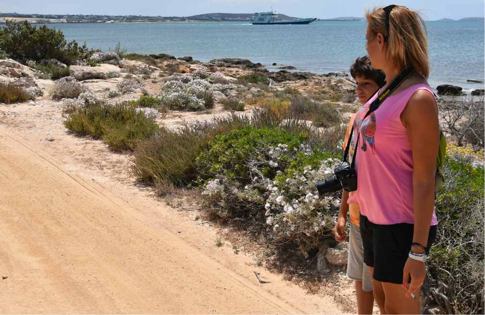
Early morning or late afternoon to avoid the midday heat in summer.
- What to bring
Don’t forget to pack water, sun protection, comfortable footwear, and a map or GPS device. Hiking poles can also be helpful.
- Respect nature
Stay on marked trails and carry out all trash.
Looking for more trails on the island? I eagerly recommend discussing with the locals for alternatives. They are the best source of information to discover Antiparos on foot!
Pin for Later!
Hiking Trails in Antiparos